Marmaris and Grand Tour of the Bozburun Peninsula

***  Here is the usual reminder to view the blog at http://www.sandysails.wordpress.com rather than in your email to see the images in their correct format if you are ‘following’ the blog.


We were blessed with another great sail from the Gocek area toward Marmaris in 15-20+ wind.  Lots of big rollers as the day progressed.  We have had outstanding weather in September in the Med.

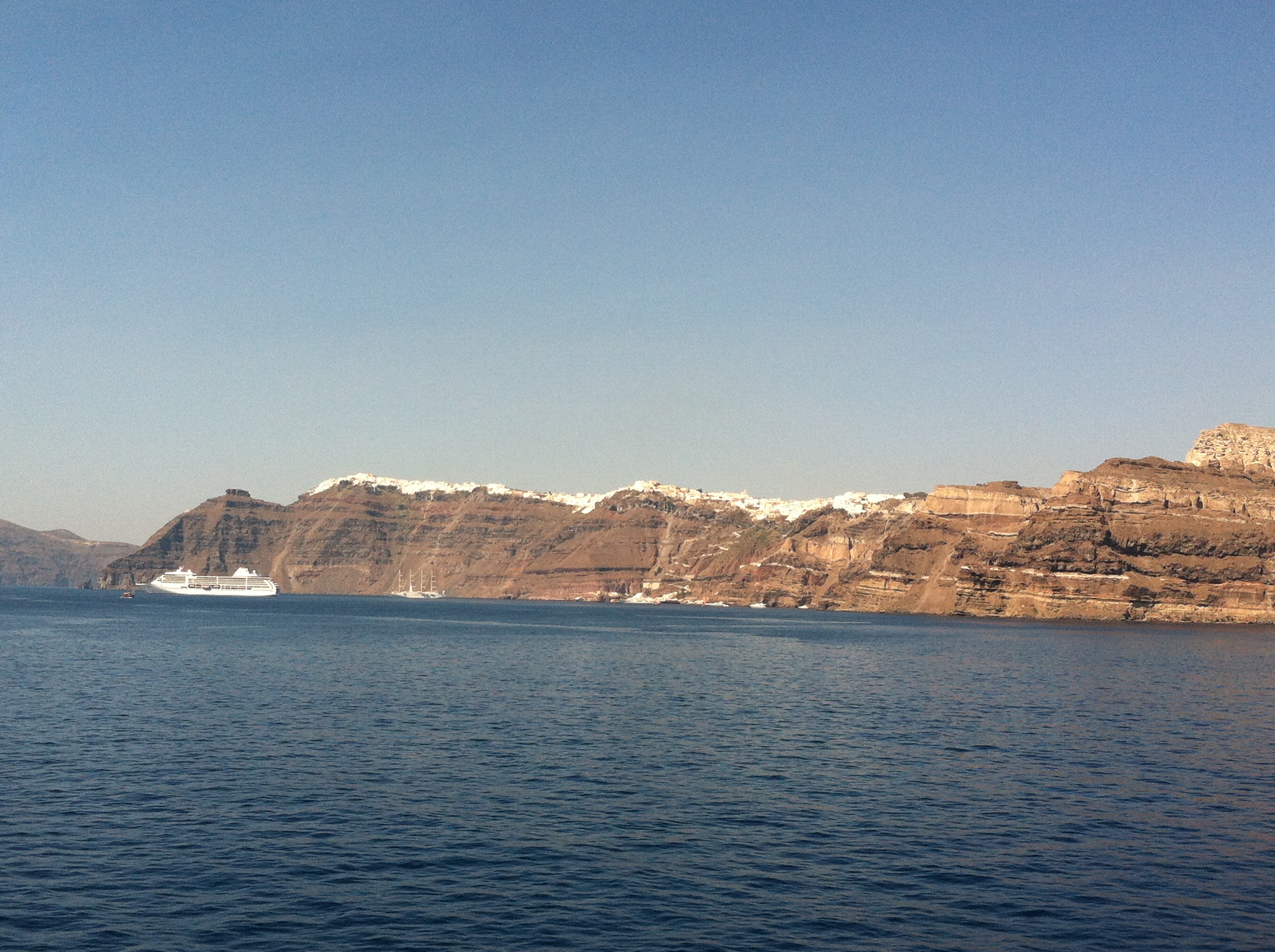
It was a long sail as there really aren’t any places to anchor between Gocek and Ekincik(which is near Marmaris). We sailed for around 7-8 hours and covered around 40 nautical miles.

We arrived in time to get our anchor set and line ashore before sunset.  The rollers into the bay were quite significant but we managed to tuck into a small cove with calm waters and only a few Gulets as our neighbors.  A quick line ashore and we were set for the evening.

View from our anchorage at Ekincik

View from our anchorage at Ekincik

We had read about an interesting restaurant in Ekincik bay with great views and went over in the dinghy for dinner.

My Marina is a small marina in the bay with about 20-30 spots for cruisers and a pretty restaurant up the hill.  The walk up was quite interesting to navigate as it is a fairly steep hill covered in stone that is easy to trip on and a bit slippery in places!

Sunset from the docks at My Marina, Ekincik

Sunset from the docks at My Marina, Ekincik

When we successfully arrived at the top, we found the very quaint restaurant and its servers all dressed like sailors which was a nice touch.


One of our favourite things  about the food in Turkey is the Mezes.  These are appetizers.  In Turkey, they are brought to your table ready to eat and you choose which ones you would like.   Alternatively, they are displayed in a glass case inside the restaurant for you to peruse and make your selections.   Many of them involve fresh tomatoes, eggplant (aubergine), and hot dishes including calamari and grilled octopus which tastes very good!


We had a lovely dinner and the sunset and views were worth the trip and the climb!

The following morning we sailed to Marmaris which was very beautiful and not too far.

Beautiful Coast - We could see why this area is so popular!

Beautiful Coast – We could see why this area is so popular!


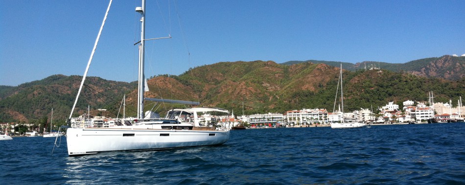
We arrived in Marmaris around 3 pm and anchored right in the harbour just off the beach and very busy vacation destination of Marmaris.


The Lodge anchored at Marmaris

The Lodge anchored at Marmaris


Marmaris is a very busy place, jam-packed with hotels, beaches, and tourists.  Despite the development, Marmaris and the bay of Marmaris are very beautiful.

We anchored the boat and headed into shore to see some sights and investigate renting a motorcycle or scooter to see more of the area.

We ‘parked’ the dinghy at the Marmaris marina in a safe spot and walked along the waterfront which is a beautiful stone walk way with numerous sculptures and fountains.  We were surprised at how pretty it was.  We walked past all the restaurants and decided to take a taxi to the nearest scooter rental spot.

We were in the process of choosing a scooter and noticed one of the fellows was very muscular.  Turns out he is a champion body builder and has won ‘Mr. Turkey’.  We just never know who we will meet in our travels!

IMG_5786

Mr. Turkey


The day was getting later so we didn’t venture too far.  We did drive around Marmaris and over to the next bay, Icmeler which is full of beaches, hotels, shops, restaurants, and more tourists.  Despite all the development, it is still very pretty and we noted that the majority of tourists were from England.  Turkey is a very nice place to take a beach holiday.  The hotels and food are very affordable and the beaches, scenery, and weather are outstanding.

IMG_5790

Icmeler Beach


The following morning, we headed back to shore with a big bag of laundry and the hopes of touring around the peninsula.

As luck would have it, just as we tied up the dinghy, Rob spotted a fellow on a scooter with a laundry sign.  We arranged for him to do the laundry and drop it into the dinghy while we enjoyed our day.  Awesome service!

We began our tour climbing out of town and into the hills and mountains.  Our ‘circle’ route  was recommended by the fellow who rented us the scooter and he also pointed out the best spots to stop for views and to enjoy a great lunch.

View looking back at  Marmaris as we climb the hills

View looking back at Marmaris as we climb the hills


Below is a map showing the Bozburun Penninsula so you can see the area we toured.

Bozburun Peninsula


We started by driving out of Marmaris toward Hisaronu and followed the coast toward Orthaniye, Selimiye, Bozburun, Sogut, Bayir, and back through Icmeler to Marmaris.  We were sure to have a full day!

As we drove through the mountains and hills, we spotted many adventure Jeeps taking tourists on ‘off road’ tours which was interesting.

Our first stop was a place called Orthaniye.   It is quite famous for its red sand bar.  You can walk quite far out onto it and even make it look like you walk on water.  The legend is below:

IMG_5803


Walking the Red Sand Bar

Walking the Red Sand Bar


Orthaniye  is very popular for cruisers and we weren’t sure we would have time to get here with The Lodge so it was great to see it.

IMG_5804

Looking Bak to the Red Sand Bar as we continue along the coast road – There are 2 people ‘walking on water’ near the end of the spit


The coast road was very pretty.  It wound its way around many bays and we got a great feel for the area.

Our next stop was Selimiye, a very beautiful bay and one visited by many cruising boats.

We were recommended to have lunch here as there is a really amazing fish restaurant.  With the help of some local people, we were able to find Sardunya Restoran, a fish and seafood specialty restaurant right on the water in Selimiye.


After lunch, we took some time to stroll around and see this quiet, lovely place.

Selimiye Harbour view with Transparent water

Selimiye Harbour view with Transparent water

As we left Selimiye, we climbed another hill and got some great pictures of the harbour.

IMG_5830

Selimye

Selimye

The next town on the great circle tour was Bozburun itself, which the peninsula is named after.  It is very small with only one main street, a small marina, and several harbour restaurants catering to ‘yachties’ like ourselves.

There were many great anchorages and we saw plenty of sailboats in Bozburun.

A quick look at Bozburun and we were off on the scooter towards Sogut.  We saw some really cool stuff along the way.

We found a bay where they were building brand new Gulets.

And some farmers too…

As the road took us away from the sea, we had to ride through the mountains to get back to the Marmaris coast.  It was very high and took a good hour to get through but was very scenic.

Riding the Mountains of the Bozburun Peninsula

Riding the Mountains of the Bozburun Peninsula


When we were about 2/3 of the way through the mountains, we passed through a mountain town called Bayir.  The descent into it was steep and when we got there we kept seeing small tables and displays at the side of the road selling honey.  We also saw hundreds of blue coloured bee boxes tucked into the pine trees.

As it turns out, this area is a major producer of pine honey.  Yes, pine honey.  It is pure because there are no flowers or other kinds of trees other than the mountain pines for the bees to pollenate.

We stopped at the Honey House, a museum of the tradition of bee-keeping in this area in a small town called Osmaniye.

We tasted the pine honey which isn’t quite as sweet as flower honey but very unique and delicious.  We also got to taste a teaspoonful of bee pollen.  It tastes like flowers.  Of course, I learned later that some people have extreme allergic reactions to it and we should have only tried a grain or two….

IMG_5860

Blue Bee Boxes – there are hundreds of them in the area

IMG_5871

Couldn’t resist the touristy shot!

The ride around the peninsula was really amazing and it was incredible how much we were able to see in one day.  We started at around noon and arrived back in Marmaris around 7:30pm at night.  What a tour! (Yes, our butts were a little numb)

We had no choice but to finish the day with cold beer and a great meal on the waterfront in Marmaris.  We had some fresh grouper which was excellent and we enjoyed as we don’t eat fish too often due to its high price in the Med. ($120 per kg in restaurants)

Marmaris Waterfront at Night - We ate at one of these spots called Liman

Marmaris Waterfront at Night – We ate at one of these spots called Liman


My favorite sculpture at night

My favorite sculpture at night


This was a really memorable place and we will have great memories of Marmaris and the Bozburun Peninsula.

Sailing to Gocek – The Heart of the Turquoise Coast

Turkey has certainly turned out to be a really great place to sail but also to explore on land.

Having enjoyed our tour around Fethiye, we sailed toward the famous Gocek area.

We had another good day of good wind and enjoyed lunch as we passed behind an island along the way from Fethiye.

Sailing to Gocek from Fethiye

Sailing to Gocek from Fethiye – Just leaving Fethiye Harbour


We arrived in the Gocek area and anchored just off Gocek Adasi (Gocek Island) just across from Gocek Harbour and D-Marin.

The Gocek area is truly the ‘BVI’s’ of cruising on the Turquoise Coast.  The area is protected in order to preserve its beauty and keep its crystal clear waters intact.

Gocek is a whole area of cruising within a radius of under 10 nautical miles.  Below is a photo of the map from our pilot book.  (We have relied on these Pilot Books throughout all of our cruising through the Med).

You will see areas of Red and Orange indicating areas where you cannot tie a line to a tree or have to attach to a stake provided onshore or a mooring ball.  We started out on the North East corner of the island(Gocek Adasi) with a line ashore to a rock.

Map of Gocek Cruising Area from Rob Heikell's Pilot Book

Map of Gocek Cruising Area from Rob Heikell’s Pilot Book


Well, our anchorage did not work out so well.  The water where we had to drop anchor was deep and a change in the wind caused it to drag and after adjusting about 3 times (That’s 3 swims for me…) we realized we would not be safe for the night so we pulled anchor and headed south.

We motored into the first 3 bays south and eventually found a spot in Boynuz Buku on the south side of the bay very close to the entrance after around an hour.   We were relieved to be settled before we ran out of daylight.

The depth is very deep (up to 80 feet near the shore) in all of these bays making it challenging to anchor even with a line ashore.  We have about 185 feet of chain which is clearly not enough around here!!!

We also discovered that this place is incredibly popular (because of its beauty, lack of swells and perfect weather) making it was tough to find a spot to anchor this late in the day.

IMG_5720

Gulet at Boynuz Buku – Gocek


The following morning, we motored back up to Gocek Adasi and since it was only around 10am, we found a much better spot to anchor with our line ashore.  The water was warm (around 85 degrees here) and crystal clear as advertised.

IMG_5724

Great Anchorage at North West tip of Gocek Adasi (Island)


After a refreshing swim, we headed to Gocek Harbour in the Dinghy to wander around and have some lunch.

We ‘parked’ the dinghy at one of the larger marinas and started our tour through town.  Gocek is very new looking and 90% of the businesses or more are dedicated to the boaters who are cruising here.

Prior to the discovery of this area as being a pristine spot to cruise, it was a sleepy agricultural village.  As a result of all the boaters cruising the area, it has developed into its own little cruiser’s ‘mecca’.

We saw more yacht chandleries, markets, and upscale gourmet shops than would be normal for a place that is about 1 km in length.  It really reminded us somewhat of our Intrawest Village at home in Collingwood.

Our first errand was to find a way to reconnect to the internet.  We found a ‘Turkcell’ shop and they were able to sell us a mobile wi-fi unit for the boat similar to the one we used in Greece.  They needed a passport which we had not brought with us so the salesman said he was Rob’s ‘brother’ and used his own so we could open an account and be able to use our computers on the boat.

IMG_5727

They look like brothers don’t they?

We stopped for lunch at a great spot near the water under the shade of some trees which was important given the over 90 degree temperature.  Rob chose the place as it had the most people and it was a good one!

After our relaxed afternoon in Gocek, we headed back to Lodge and discovered we had some new neighbors! We were now the little fish….


Our Greek Neighbours

Our Greek Neighbours


The next morning, we headed back down towards the bays and decided to stop in Tomb Bay to take a look.

Tomb bay has a group of  Lycian Rock Tombs carved into the cliff, hence the name.  They are more cave-like than the elaborate ones we saw back in Fethiye but most impressive  looking at their location!

Tomb Bay also has an interesting painting of a large fish on a rock just to the left of the Tombs near the water.

The Lycian Rock Tombs at 'Tomb Bay'

The Lycian Rock Tombs at ‘Tomb Bay’


Since it was still early in the day, we left Tomb bay, motored past Deep Bay (which was too deep for our anchor chain) and on to Sarsala Koyu.  We liked the look of the Sarsala Koyu and found a Mooring ball with a steel stake on shore in a great spot with no neighbours.

We got ourselves organized and enjoyed the afternoon.  We did have visitors though.  Two of them.

The first, a 145 foot yacht, the Dias.  Even the pro crew had to reset the anchor twice before getting a good hold in the deep water which made us feel better about our challenges.  The crew member running the lines ashore with the fancy rib came over for a chat and is a former British Finn sailor.  He told us they had 11 crew in total and the dynamics were interesting!

The Dias only stayed for a few hours which was enough time to pick up the owner and guests on shore, load them on board and they headed out to another bay.

The Dias at Sarsala Koyu

The Dias at Sarsala Koyu


Our second visitor, was a very large loggerhead turtle.  They nest not too far from here and it was really great to see one of these amazing animals.  It was so large, we though it’s fins were eels or dolphin fins before we could get a good look when it finally surfaced.  Apparently they can reach a length of up to 73 cm.  They have a heart shaped shell (Carpace) and are omnivorous.

So excited for this visitor

So excited to see this visitor


We would have loved to have spent more time in Gocek and we could see that you could spend two weeks or more cruising in this area without having the chance to visit and anchor in every spot.

There are many charter companies including Neilson, Dream Charter, and Sunsail whom most of us know from the BVI’s so planning a trip here is not very difficult.  Then there are the hundreds of Gulet’s for charter as well.  Let us know if any of you plan to go!

We needed to move on to ensure we saw more of the coast and got back to Didim in time to haul out so we left with hesitation towards Marmaris, another very pretty area for cruising.

Leaving Gocek - You can see all the boats behind us in Sarsala Koyu

Leaving Gocek – You can see all the boats behind us in Sarsala Koyu

We were overwhelmed there were so many beautiful bays!

Great Memories

Great Memories – Wow!


Fethiye – Lycian Rock Tombs, Ghost Town, Moto Tour….

** Same reminder… If you are ‘following’ the blog, view it online at http://www.sandysails.wordpress.com rather than in your email to see the pics in nicer format.


The weather was great sailing to Fethiye.  Once again, the wind was behind us and the sun and blue sky did not disappoint.  We anchored at Fethiye just off the main marina after a long days sail in the late afternoon.

IMG_1722

View from our Anchorage on The Lodge at Fethiye


We had dinner on the boat and watched the sunset and the full moon rise which was really pretty.


Sunset at Fethiye

Sunset at Fethiye


The adventures start early with the Butlers.

About 20 minutes into a scooter trip up the mountain and down an unmarked road (dirt off-road) where there were no other vehicles or people, I glance down to see the bike is on EMPTY.  We stop, open the tank, and we need to get fuel asap.

Of course the rental guy told us it was full.  (Any good pilot knows you never trust the gauge of the scooter or the dude renting you the bike.)

We turn around and turn the scooter off while we descend on gravity, hoping so get back to town for gas on what fumes we have left.  Seems we have done this a few times on this summer and last year.

We made it back to town for fuel and started again.

We found one of the famous groups of Rock Tombs which are right in town carved into the steep rock faces.  They were put there by the Lycians in the 5th century BC.  That is pre-Greek if you are wondering just how old that is.  The Lycians believed the souls of the dead would soar out of the tombs to the after world and so the majority of them are on rock faces and cliffs.  How they got up there is a head scratcher!

The tombs mimicked the wooden architecture of the homes and buildings of the time and have provided great insight into the Lycians.

These tombs are quite common between Antalya and Fethiye.  They were known as hard-working, wealthy people who were quite neutral in regard to world affairs but fiercely defensive of their freedom.  Historians refer to them as the ‘Ancient version of Switzerland’.

Next, we toured back up the mountain and down to a ‘Ghost Town’.    The road wound up and down the mountain and was in terrible condition which we were acutely aware of as the scooter we rented had shocks which had seen better days!  After almost an hour, we wondered if we were lost when we saw a rough sign on the road indicating we were close.

Called, Kayakoy, this ‘Ghost Town’  was inhabited by ancient Greeks until 1922 when the Turkish took over the area and the Greeks moved back to Greece.

The Turkish never inhabited the abandoned town, and it stands today as a really interesting place to visit.

IMG_5685

Kayakoy – Ancient Greek town near Fethiye, Turkey


We wandered down the dusty trail in the heat and found the centre of the village.

There was a fellow offering camel rides and the usual tourist souvenirs.

In the corner, we smelled something really good and were lured in.  We found an old restaurant with turkish tapestries covering all the seating and tables.

At the front, a wood fireplace with two Turkish women making pancakes by the fire.

We sat down and promptly order two of  ‘whatever those gals are making’ which was spinach and cheese pancakes.   The ladies pound out the dough and roll it up using a skinny rolling-pin.  With grace and skill, they roll the dough onto the grill and begin baking it over the fire.  After a few minutes they whisk it back onto the roller, add spinach and cheese and then back it goes into the wood fire oven to be finished.

Price for two pancakes, a water and a diet coke?  About $6.

The experience – Priceless!!

The 'real deal'

The ‘real deal’


Camel Ride anyone?

Camel Ride anyone?


Thoroughly impressed and no longer hungry we continued down the road to see some of the bays in the area on the coast.

First stop, Gemiler Buku and the island just off of it, Gemiler Adasi.  We were pleased to see this bay as we had chosen not to sail this far south.

The journey to these places seems often as interesting as the places themselves.  We took a good look around and headed off to another  bay anxious to see more.

We have really enjoyed having either our motorcycle or a rental scooter to be able to go inland and see so much more of these countries while we have the opportunity.  We can cover a lot more ground and we have had some colourful adventures.

Below are some photos we took along the way.

On our way to the next bay, we passed through a pretty mountain town, Ovacik that really looked  like it had some Swiss influence.  Plenty of shopping here.  They seem to specialize in knock off clothing, bags, sunglasses and watches not to mention all the usual fridge magnets.

I spotted a hair salon and Rob got a much needed haircut while I got a pedicure.


Only a few kilometers away was the beach town Oludeniz.  It is a valley full of hotels, pools and water slides leading to a pristine beach and a blue lagoon.  Sailboats used to anchor in the lagoon but due to too much pollution ( and a lack of water flow in and out of the lagoon) they are no longer allowed in the hopes the water will clean up over time.

Oludeniz on the Right, Blue Lagoon on the left

Oludeniz on the Right, Blue Lagoon on the left


We parked the motorbike and took a walk down a wide stone boardwalk.  Plenty of people but good facilities and plenty of room for everyone to enjoy.  As we left, we looked up and saw no less than 25-30 Paragliders launching off Babadag mountain nearby and landing eventually on the beach at Oludeniz.  That was indeed quite a sight.

Awesome day exploring The Turquoise Coast near Fethiye, Turkey.  We made it back to Fethiye just around sunset, in time to enjoy dinner at the local marina and think about where we would sail to tomorrow.


Cruising The Southwest Coast of Turkey – We are finally here!

** Quick reminder that if you are ‘Following’ the blog, the format is not very good.   View it at http://www.sandysails.wordpress.com to enjoy the photos.


This summer of cruising has been quite an adventure and Greece is such a huge country with an unbelievable number of islands.  What is interesting is how each one is different and has its own character and personality.

We did not do a lot of research on Turkey other than to learn it is very popular for cruising.  As a result, we  really did not know what to expect of Turkey so this was going to be a true adventure and different experience for us on ‘The Lodge’.

We started our tour of Turkey by sailing to D-Marin in Didim, on the coast of Turkey.  It was recommended by a number of sailors we met over the course of our cruising in Greece.

We had a lovely sail over from the Greek islands and saw our first flying fish.  I had heard of these but had never seen one.  They literally fly out of the water and sail over the tops of the waves.

D-Marin is one of the largest and finest marinas we have been to in the ‘Med’.

D-Marin has a beautiful hotel, shops, restaurants, pools, and the area where the boats are stored on the hard is a giant cement pad that is spotless.  There are so many businesses here to do maintenance and work on boats it is something to imagine there is enough work to go around.

A quick assessment told us this was a good place to store The Lodge for the winter!  Arrangements were made to haul out on Sept 26th.

We did some laundry, washed the boat, sails, polished all the stainless and prepared to head south.

We decided to get as far south as we would go and then work our way back.

Our first stop was Gumusluk, a very pretty place with a long sheltered bay.  It was so busy we chose to anchor outside the bay near a beach.  We watched the sun set and enjoyed the views which were really quite lovely.  The shore was dotted with beach umbrellas and small restaurants although we elected to have a nice dinner on The Lodge.

IMG_5482


On our mission to get south, we left Gumusluk and headed all the way to Knidos, which is at the very tip of the Datca peninsula of Turkey.  We sailed around Kos which is a Greek Island and enjoyed some Greek internet as we passed by!

Below is a good map showing the Coast of Turkey with the Greek Islands.  As you can see, the Greek islands are very close to Turkey.  Symi is almost surrounded by Turkey.

Map of Carian Coast of Turkey


Knidos is a very enclosed bay with warm crystal clear water for swimming.  It is also an important archeological site.

The ancient (Greek) city of Knidos was built around 360 BC and is just under a mile long.  Knidos Ancient City has two sides which were connected by a bridge which is now a sand isthmus. ( If you want to see plenty of Greek ruins, come to Turkey.)  It was a rich city with an agora (marketplace), 2 odeons (amphitheaters), and 3 temples.

The ‘lower’ odeon/amphitheatre  is right next to the anchorage at Knidos and excavation is still going on to bring the site to a better state for visitors.  It holds 5,000 people.  There was a larger odeon which is further up the hill and has yet to be excavated.

Knidos-nasasat-hq

Google Earth image of Knidos shows the area of ruins is quite extensive. They believe this area will rival the famous Ephesus when the excavations are finished.


The next leg was to sail from Knidos to the Marmaris area.  If you look at the map, you will see we passed by Symi which is tucked in between the Turkish peninsulas Datca, and Marmaris.  More great weather with another fast sail on a broad reach taking advantage of the prevailing winds.

Marmarmis is a major holiday destination and is highly developed for tourism.  The majority of tourists we saw came from England although they also have some German, Dutch, and French visitors as well.

The first thing we noticed about the Turkish coastline is how much green there is.  That is quite a contrast to the dry, barren Cylclades islands in the Aegean.  The other thing we noticed was the sheer numbers of boats cruising the area.  It is like the ‘401’ of  cruising.  Sailboats, power, high-speed zodiacs, yachts and Gulets everywhere.

Gulets are traditional Turkish masted wooden sailboats built in the Bodrum and Marmaris area.   They have two masts and vary between 14-35 metros in length.  Although they look like sailboats, only a few actually have good working sails and even fewer use them.  Typically they blasted past us with their big diesel engines doing 10 knots or more.  There are literally hundreds of them.  Although some are privately owned, the majority are charter boats and do everything including day trips, 14 day cruises, and custom tours around the southwestern coast of Turkey which of course is where we are.

We toured a number of bays near Marmaris and decided to stay in one called Kumlubuku. (Say that five times fast…)  Turunc Buku, a neighboring bay looked like good shelter but was jammed with hotels, Gulets, Parasailing boats, etc….

We found a small cove within the larger bay and had a wonderful swim.  I enjoyed a good paddle board in pretty calm waters  for just over 2 nautical miles around the Kumlubuku bay area.  The leisure craft sure put out a good wake and so keeping upright  was still a challenge!

We took the dinghy ashore to the Kumlubuku Yacht Club restaurant and had a a somewhat unorthodox dinner of Turkish and Chinese cuisine.  Although the combination sounds odd, the grilled octopus was delicious and it was a nice change to have some asian food.

Tempting as it was to stay in Kumlubuku for a day of swimming and relaxing, we headed further down the coast to our most southern port, Fethiye.  Our plan was to return to the Marmaris area on our way back and see more of this really rugged, amazing coastline.

We sailed over 45 nautical miles on a pretty direct route in really great downwind conditions.  Turkey in September really seems to be an excellent place to cruise.

Arriving at Fethiye, we were ready to slow down and really explore the Turquoise Coast or ‘Turkish Riviera’.

Exploring Symi, Greece with The Lodge and by Scooter Island Tour

***Just a reminder, if you are ‘Following’ the blog, view it at http://www.sandysails.wordpress.com to enjoy the photos.


We passed through a very small, shallow (but navigable) gap between the north end of Symi and an island which is only about 100 meters away.  Below is a short slide show of our passage through the gap.

This slideshow requires JavaScript.


The highlight of Symi is simply sailing into its amazing harbour.  It is stacked with lego-like pastel coloured buildings in an amphitheater surrounding the harbour itself.

IMG_5532

Symi Town with Pedi Bay to the distant right

Symi Town with Pedi Bay to the distant right


Symi is a small Greek Island in the Dodecanese chain of islands just off the coast of Turkey.  In fact, you will see it is surrounded by two peninsulas of the Turkish coast.


Anchoring in Symi is a challenge as the winds gust down the steep slopes into the harbour blowing you off course as you try to reverse into your place.  The other factor is that the water is incredibly deep so deciding when to drop the anchor is critical.  Rob had me drop anchor about 3 boats over and we were ‘pushed’ into our spot on the cement wall.

Symi is a bustling little place despite its size and no sooner had we landed, the local fuel truck drove by.  Rob hailed him and we took the chance to fill the tanks.

Fill'er Up!

Fill’er Up!

We rented ourselves a scooter to explore the island and off we went.  That did not last long.  The scooter had bad mirrors, bad brakes and could not climb hills.  I had get off and hike up the hill so we could coast to town and get a better ride.  Oh well… I got my exercise for the day!

We got a newer more powerful scooter and started over with the tour.  First, we headed around the Harbour to a place called Eimborious.  A very quiet sleepy place with beach umbrellas and holiday villas.

The sun was setting so we headed back to town for dinner.  We walked around and discovered there is a main road which is really a very long staircase up the hill of Symi.  It is lined with restaurants, shops, bars, and interesting sights for sure.  Rob spotted an old Pharmacy from 1884 which was really cool.

We found this really interesting place to have dinner, The Windmill. (Thanks to the internet and Trip Advisor)  It was a really cool spot with only two small rooms inside the old windmill for preparing dinner.


Lots of small dishes like Tapas.  Delicious!

The next morning after a great omelette and getting some laundry done, we started by heading to Pedi Bay, the first bay south of the harbour.

Looking down to Pedi Bay on Symi

Looking down to Pedi Bay on Symi


Next, we decided to climb to the highest point on Symi which is over 2000 feet.  We had to do a little ‘off-roading’ to get there but you know what they say…”It’s a rental!”.


The view....

The view from over 2000 feet


Our next stop was to head to the far end of the island to see the famous monastery at Panormitis.

We got within about 45 minutes of the Monastery and realized we were almost out of fuel.  So… We had to head back to town to refuel and start again.  There is only one gas station on the entire island!!!

After at least a dozen switchbacks we made it to the Monastery at Panormitis.

What is most striking is its sheer size.  When we first spotted it from high in the hills, we were sure is was a resort.

IMG_5610

Relaxing with a view down to the Monastery at Panormitis – Looks like a lovely resort!

The church is thought to be around 450 AD with the ‘resort’ seen today  constructed during the early 18oo’s.  It is still inhabited by monks.  I wandered into the chapel and they were doing a baby christening.  A little too much incense for me so I didn’t stay long.

The clock tower was very ornate and is apparently the tallest baroque bell tower in the world.  The view from the arch entrance back to the bay quite striking.

Highest Baroque Bell Tower in the World -

Highest Baroque Bell Tower in the World –

As we were about to leave, I saw a sign for a bakery in the Monastery and bought some cookies for the trek back up the switchbacks and journey back to Symi Harbour.

When we left Symi Harbour, we had noticed a running group about 10-12 fellows looking very fit.  We knew they would have to run up these steep hills as there is no other route.  Driving back from Panormitis, we saw them and it was incredible the altitude (2000 vertical feet) and distance they were running!


Back in the harbour we dropped off the rental scooter and strolled around the harbour back to The Lodge.

We dined at a traditional Greek Taverna directly opposite The Lodge which was lovely and terribly convenient.

Symi is lined with lots of little shops and tavernas with a really good vibe about the place.  The locals are very friendly and seem to be very happy on their little island.

Before we left, I managed to get to the second floor of a little cafe (which made great omelettes) and take some pics of The Lodge before we left this very picturesque place.

The Lodge

The Lodge

IMG_5584

The Lodge is in the group of Masts on the Right

Great adventures here and so glad we got to see this great looking island, Symi.  It was hard to take a bad photo here!

Now friends… we explore Turkey!


Patmos, Greece – More excellent adventures…

Hello Friends…. First I would like to ensure that if you are ‘following’ this blog, be sure and look at it at http://www.sandysails.wordpress.com and not on your email where none of the photos will look as I have shown them in the blog,  Enjoy!!!!


After a great time exploring Santorini and Mykonos, it was time to sail across the Aegean to the Dodecanese Greek Islands which lay just off the Turkish Coast.

We had a tough time with the Meltemi blowing.  Our best window of opportunity was to leave as the sun rose at 6am.  It was still dark at 6 am when we left the Mykonos Marina but the winds were down to around 10 knots and it was a good time to try to cross one of the wide open areas of the Aegean.

IMG_5754

Mykonos to Patmos – Approx 65 nautical miles Photo of our Pilot Book which has been invaluable


We left Mykonos Harbour and headed East to Patmos.  Patmos is a small island full of bays south to the larger Greek Island, Ikaria.  The sail would take around 10-12 hours at around 65 nautical miles.  Forecasts were for winds into the 20’s but not 30’s as we had seen over the past few days.

The sail went well.  We had good winds around 15-18 knots and winds well over 20 knots off the tip of Ikaria.  We sailed over the top of Patmos and around into the east side of Patmos which is one glorious bay after another.

We toured up and down the various eastern bays and settled in one called Agios Agriolivado.  It was nice and deep with great shelter from the Meltemi and had a small island at its entrance which added further protection.  We anchored and headed to the bay next door, Kambos for a lovely traditional dinner of moussaka, stuffed tomatoes and grilled aubergine(eggplant) with tomatoes and melted cheese.  A great way to end a long sail!

Patmos was formed by ancient volcanic eruptions.  It is a relatively small island and the bays best for shelter are all on the east side.  The west is exposed to the Meltemi winds and the western bays are formed by very steep cliffs.

IMG_5753


On our first full day at Patmos, we headed to shore in our dinghy. After a quick iced coffee at the Skipper’s Bar at the beach we took a taxi to Skala town which is the main port on Patmos and rented a motor scooter so we could explore the island.

We quickly discovered that this was a very pretty place and worth a couple of days exploration.

IMG_5351

Looking to Merkas Bay (left) and Skala

Looking to Merika Bay (left) and Skala

I couldn’t do a Panoramic shot, so the next one is just to the right of this one looking north to the East Bays of Patmos.   Not a bad view!!!

IMG_5358

We climbed up to the Chora where these shots were taken and around to the south side of the island.

We found Grikos which consists of two bays and several lovely beaches.

IMG_5370

We left Grikos and headed all the way north back past where we had anchored ‘The Lodge’.  We checked to see she was not moving from her anchorage as the Meltemi was blowing quite hard and headed north to do some more exploring.

IMG_5375

‘The Lodge – Just Right of the Centre of the Bay

We took some real goat path type roads north to a place called Agios Nikolaos.  The road ends at the top preventing a tour down to the sea but the views up the coast were really terrific.

Rugged West Coast of Patmos with Meltemi Blowing onshore

Rugged West Coast of Patmos with Meltemi Blowing onshore

As we worked our way back we found Lefkes, a dramatic bay on the West side with the Meltemi blowing hard into it.  We could see a very small shack-like building and we went to investigate.

Lefkes Bay - Patmos

Lefkes Bay – Patmos

The ‘shack’ was an old camper (circa 1970) turned into a small cantina by the sea.

We went in for a beer and found some really great food.  Octopus salad with sweet ripe tomatoes and Tzatziki (Yoghurt with cucumber, garlic, salt, olive oil and lemon) were great and the beer was cold and refreshing.  We met a lovely couple from France who had discovered this spot and returned for more Octopus salad.

The view was fabulous and the place, Kantina (Canteen) was classic.  Picnic tables covered with tapestry type cloth, funky painted gourds hanging from the palm lined roof, and odd pieces of painted art on the single wall.  Very cool.

The Meltemi were blowing so hard they blew my lemonade over!!!

Beach at Lefkes - Good surf

Beach at Lefkes – Good surf


So now the unscheduled excitement began.

We thought we would go back to Skala town and have a look around.  We passed by our bay in Agriolivado on the way so we paused to make sure the boat was still safe at its anchorage given the strength of the winds.

The Lodge had moved across the bay!!!  I could see it was not on the rocks but it was close. Heart rates went spiked and we scurried into the bay as fast as we could and piled into the dinghy to rescue the boat.

It was very close to peril and our timing was incredible.  We hopped on board, raised the dragging anchor and re-anchored tucked up in the corner of the bay. Needless to say we did not venture back to land for the rest of the afternoon.  We stayed put to ensure The Lodge did not move again!  Phew!!

Resetting the Anchor and hoping it won't drag this time!

Resetting the Anchor and hoping it won’t drag this time!

The following day, we drove back past Skala up to the old town, The Chora to see the famous Monastery of St. John.  Apparently, John wrote the book of Revelations here on this island and even mentioned it in his writings.

Monastery of St. John - Chora - Patmos - Greece

Monastery of St. John – Chora – Patmos – Greece

I never tire of that intense colour of blue…


What I have not mentioned, is that we really had a hard time finding the monastery.  Somewhat exasperated from wandering the chora unable to find the Monastery entrance,   we stopped for a coffee at a cafe overlooking Patmos with Jimmy on ‘Jimmy’s Balcony’.

Turns out Jimmy is quite a guy. Jimmy was born of greek parents in Houston, and had lived all over the states before returning to Patmos to open his restaurant and enjoy his retirement. Below are some photos I took as we wandered the Chora.


The locals all encouraged us to go look at the famous ‘Cave’ where St. John wrote the book of Revelations.  The Cave had had a small church built around it to preserve it and to make it easier for visiting.  It was not that exciting but we did it and here it is….


It was time for lunch and we found a lovely restaurant, over 35 years old near the beach in Meloi.  The entire roof of the patio was a vine over 30 years old.  Very cool and breezy and a great lunch.  After lunch, we were ready to tour some more of the island.

We were curious about the far south of Patmos which we had not seen so we did some exploring in that direction.
We found some really pretty areas and climbed an unreal path up to what was the high point on the island with a small church at the top, Profits Illias.  The church dated 1764.

IMG_5458

Amazing and worth the climb!!

We were really pleasantly surprised at how beautiful Patmos was.

Next stop is Symi, another Greek Island and our last stop before checking into Turkey.

Breathtaking Santorini

After a lovely breakfast at the hotel across from the Mykonos marina, we headed over to the ferry docks excited to finally be going to see the famous ‘Santorini’.

The ferry was over an hour late as one of its engines was compromised but we boarded and off we went.  I paid the extra 10 euros for upgraded seats which was great as the ride was longer than anticipated.  The trip was supposed to take around 3 hours but was  closer to 4.5 hours with the engines not being able to go full speed.  No worries!  We were going to a beautiful place.

Santorini is the remains of the top of a giant volcanic explosion.  It is what is left of a caldera, a cauldron-like volcanic feature formed by the collapse of land following a volcanic eruption.  The lava bursts up and then collapses leaving a ring-shaped island behind.

What I found interesting was that the island has relatively gentle slopes from the top of the caldera down to the sea.  This leaves plenty of room to grow grapes which are used to make the finest wines in Greece.

santorini aerial view

The volcanic soil gives an amazing taste to the grapes which is likely one of the reasons the wines are so good here.

Arriving in Santorini by ferry is truly something.  It is hard to describe how dramatic the island is and how excited everyone gets when it first comes into sight.


Breathtaking...

Breathtaking…

From the moment one arrives in the caldera of Santorini until departure, the views are amazing.

Here are a few I took as we climbed the hill from the ferry port.

Rush Hour as Buses, Cars, and Motorbikes climb up the Cadera from the Ferry Docks

Rush Hour as Buses, Cars, and Motorbikes climb up the Cadera from the Ferry Docks

View up the Caldera toward Fira and Imerovigli towns

View up the Caldera toward Fira and Imerovigli towns


We stayed on the opposite side of the island at the bottom of the slope at Kamari Beach.  Kamari is very pretty as it is a black sand beach and was a quiet relaxed place to call home for a few days.

There is a long boardwalk by the sea and it is full of shops, small hotels, and restaurants.

Our favorite was called Kiwi, a Thai restaurant where the cook comes every summer from Thailand.  She was really talented and we enjoyed a number of meals here while in Kamari Beach.

The South end of Kamari Black Sand Beach

The South end of Kamari Black Sand Beach

Our first day found us out on the motorcycle headed to the archeological site of Akrotiri.

This site is quite unique.  It has 3 towns from the Minoan period (over 4500 years ago) buried on top of the other, a result of the numerous volcanic eruptions.  The top town has been partially excavated and the ash from the volcano beautifully preserved the buildings, art, pottery, and even some of the furniture.  Some of the homes were 3 stories tall and this was clearly a very intelligent bunch!

The site is completely enclosed to protect the site with a new wooden roof that allows the natural light to come in while shielding the ancient town and its visitors from the elements.

Akrotiri with its newly completed Roof

Akrotiri with its newly completed Roof

I can imagine these photos don’t look like much more than a pile of rubble, but most of the artifacts were carefully removed and displayed in museums in Athens.

Below are two rooms of Fresco’s as they appeared in the Akrotiri homes on Santorni.  The preservation is really quite amazing considering they are over 4500 years old!!!

As some of you may know, I love wine.

There are not too many good wines in Greece but some of the finest are grown here on Santorini.  I did some research and found two wineries we really wanted to visit.

The first is called Hatzidakis.  We drank some wine from this winery last year when we were near Mt. Olympus and Thessaloniki at a really lovely hotel.  I have searched for it since with no luck until we arrived on Santorini.

Hatzidakis is not open to the public but if you call, they will grant you a visit.  I called and an extremely friendly woman named Kristi, who promptly invited us over.

It was tough to find but thanks to a lovely girl working at Akrotiri’s ruins, we found our way.  (She actually used to work at Hatzidakis.)

The drive from Akrotiri to Hatzidakis Winery took us back up to the edge of the Caldera and the views were simply breathtaking.

A private pool with every room....

A private pool with every room….

Hatzidakis is internationally awarded for many of its wines, not its winery.  Had we not known about the wine, we may have run from this place.  Rustic accurately describes it well.  It was however, one of the most interesting and enjoyable tours a wine lover could imagine.

As luck would have it, they were right in the middle of harvest and the beginning of crushing the grapes which made for a really amazing experience.

Kristi had us wait outside right next to the new press and de-stemming machines.  We were offered to eat as many grapes from the bins as we liked and they were really good! Our hostess was also busy helping with the press so we were able to watch it all happen.

After a good load of grapes were safely in the presses up top, Kristi led us below into the cave where the tanks, barrels and some really old presses were all hard at work.

We got  to drink the white juice right out of one of the presses and it was so good we wondered why bother making it into wine?

Finally, we headed into the cave itself and their small tasting room which is usually reserved for international wine distributors looking to bring Hatzidakis wines to their countries.

The most famous wines from Santorini are the Assyrtiko whites.  They do two versions; one which is aged in steel tanks, and a second aged in French oak barrels called Nikteri.  The Assyrtiko is clean and crisp while the Nikteri is oaky and buttery. We loved them both but Rob prefers the Assyrtiko and I the Assyrtiko Nikteri.

We also tasted their dessert wines which are 80% Assyrtiko and 20% Aidani grapes.  Delicious!!!  Rob spent some time with the wine makers and I think he is now somewhat an expert.

We left with smiles on our faces and a case of wine to balance on the motorcycle all the way back to Kamari Beach!

In the cave...

In the cave…

On the way back to Kamari, we passed the only brewery on Santorni, Donkey Beer and so we stopped in there as well.

We tasted three beers and headed home with a magnum of IPA called ‘Crazy Donkey”.

IMG_5136

After all this drinking it was certainly time for a nice lunch.

We dropped our wine and beer at the hotel and drove back out to the south of the island  near Akrotiri to the fishing village and port Vlichada.

Vlichada is the most protected spot on Santorini and is where we would berth The Lodge when we return here.  It is home to many day boats that take tourists over to the centre of the volcano, Nea Kameni for a look and a swim.

We had lunch at a spot on the ridge above the marina called ‘To Psaraki’.  It means ‘little fish’ in greek.  A simple spot with a few tables with a view, it was one of the most delicious meals we had so far.  Grilled Haloumi Cheese with pesto, Fresh grilled calamari, and cherry tomato fritters were delicious!

After lunch, we decided to head to one of the Caldera villages.  Most of us have heard of Fira, the main village but there are several.  We went to the village next to Fira, Imerovigli which is actually the highest on the Caldera so the views are worth some time wandering around here.


Great Place to Relax on the Caldera's edge at Imerovigli

Great Place to Relax on the Caldera’s edge at Imerovigli

IMG_5178


Santorini is known not only for its views and as the number one island to vacation on in the world today.  It’s volcanic soil creates superior grapes for wine and the cherry tomatoes here are quite special.

The cherry tomatoes on Santorini are definitely some of the best we have ever tasted and are on the menu in almost every restaurant in Santorini.  Cherry Tomato Fritters are to die for!

We certainly had a fantastic day on Santorini and fit quite a bit into our ‘excellent’ adventure!!

The following morning, we headed to the north end of Santorini to visit another amazing winery.  Domaine Sigalas is located on the smooth slopes below a small town, Finikia very close to the north end of the island.

Domaine Sigalas is a lovely winery with more facilities for visitors than our friends at Haztidakis.  They have a lovely tasting room and a small restaurant serving delightful food that complements each of their award-winning wines.


We loved their Assyrtiko and Nikteri and the red, from the Mavrotragano grape was outstanding.  We ate some house made dark chocolate with raisins from Sigalas with the Mavrotragano and it was really delightful.

We had a light lunch on their courtyard patio looking over the vineyard and enjoyed some dolmades (grape leaves from Sigalas stuffed with rice and served with a light lemon sauce) and a cheese plate with cheeses from a number of regions around Greece.

Lovely afternoon and we bought yet more wine.  We decided to leave it in the care of the winery and pick it up later so we could continue on to see more of the north end of Santorini.

We headed toward Oia (pronounced ‘eeya’) which is the village at the far north end of the Caldera.  It is actually the place where the famous photos of Blue domed Churches looking over the Caldera are taken.

We went first around the Caldera down to the sea to the small fishing village of Ammoudi which was worth the trek as the views looking up at Oia were amazing.  Ammoudi is very pretty itself which crystal clear turquoise waters.  We were tempted to take an unscheduled swim!

Ammoudi Fishing Village with a view up to Oia

Ammoudi Fishing Village with a view up to Oia – Ancient Windmill on the Left


It was time to head up the Caldera to Oia, the most photographed place in Santorini.  It is also the most popular place to see a sunset and literally thousands pour into Oia in the late afternoon waiting for the sun to go down.

We were there earlier in the day and had a chance to really enjoy Oia before the crowds arrived for which we were grateful.

The views are beyond even a great panoramic shot so I am hopeful you will get the gist of just how beautiful it is to spend time here.

Postcard shots in every direction

Postcard shots in every direction

Oia - Santorini

Oia – Santorini

Our hosts at Sigalas Winery had booked us into a gourmet restaurant on the cliffs of the Caldera in Fira for dinner so when the crowds started to arrive, we headed over early to Fira to take in the views.

Perhaps you have wondered how all these people get up to the top of Fira from the bottom of the Caldera?  Well, there is a cable car and the former traditional donkey ride.  A stroll through Fira and if you don’t see the donkeys, you will see evidence they have been by!


Door with a view from Fira

Door with a view from Fira

We arrived at the restaurant in Fira in time to see the sun set which was as spectacular as advertised and had a wonderful dinner at Koukoumavlos.   The Duck Burgers with Foie Gras were to die for.

Sunset over Nea Kameni, the Volcanic Centre of Santorini

Sunset over Nea Kameni, the Volcanic Centre of Santorini

After sunset, the fireworks started.  Every summer at the end of August, there is a fireworks display on Nea Kameni which can be seen from every point around the Caldera to ‘celebrate’ the volcanic eruption that created this beautiful island.

We were nearing the end of our wonderful time on Santorini.  😦

We managed to get all the wine, the motorcycle, our backpacks and ourselves to the ferry docks to travel back to The Lodge on Mikonos.  The views leaving Santorini were just as wonderful as any we had seen.

Everyone should have the chance to experience Santorini, and we were so grateful we had the chance!!

Layers of White Ash On Top of the Volcanic Black  Rock

Layers of White Ash On Top of the Volcanic Black
Rock


A private pool with every room....

Santorini – Breathtaking

Mykonos and the Meltemi

Having enjoyed exploring Syros while waiting out the Meltemi, we felt the winds had subsided enough to make the approximately 25 nautical mile trip to Mykonos.

The winds were a light 10-15 knots as we left Finikas.  As we rounded the bottom of Syros, they were a good 20 knots but as we sailed away from the island they dropped to less than 5 knots.

As we got close to the bottom end of Tinos, they quickly came in at 15 knots and hit a strong 23+ for the last 10-15 miles of the trip.  The winds famously funnel between Mykonos and the bottom of Tinos and are a good 5-10 knots stronger than any winds in the area.  They come with big waves as well providing a full adventure for all.

We wore our life jackets and bashed our way to windward toward Mykonos Harbour.  The winds were so strong we wondered if the marina would provide enough shelter from the infernal meltemi.  A tall Greek fellow, Niko, who watches over the marina helped us tie onto the cement wall and we were in good shape.

Next job was to off load the motorcycle and start to explore the island.

The marina is about 3 km from Mykonos Town so we started by heading in that direction.

View from Hotel Mezes across from Mykonos Marina - Great Breakfast and WiFi

View from Hotel Mezes across from Mykonos Marina – Great Breakfast and WiFi

We had a nice lunch by the water in town and headed along the main town road to explore further.

We discovered an area where the land pinches into an isthmus creating two bays back to back.  On the north and very windy side is Kornos where we found  a kiteboarding centre and school to be the only resident on the whole beach.  No doubt as the winds would make it uncomfortable for anything else.   We stopped to watch the kite boarders and the odd windsurfer rip around the bay enjoying the meltemi winds.

IMG_5321

On the opposite side of the isthmus was Ornos beach.  There were many boats anchored and enjoying shelter from the meltemi  and plenty of beach umbrellas and restaurants.

We stopped at one called Pajai which was only a few months old and had some great sushi!  Indeed a treat as sushi is not usually on the greek menu.  We stayed and had a good dinner returning to The Lodge for sunset and a good nights rest after our trip.

View of Ornos Bay and Beach from Pajai

View of Ornos Bay and Beach from Pajai

The next day it was time to do some island exploring.  On the advice of some locals, we headed to Panormos Bay.  Panormos Bay is a very large bay with several beach areas.  The beach at Panormos is known for its fluffy sand and there are almost no restaurants, beach bars, discos or clubs so it is popular for those looking for a more ‘natural’ beach experience.


Just beyond the beach at Panormos is another lovely quiet spot, Agios Sofia.  It is famous for Kiki’s beach shack restaurant.  A really basic taverna, Kiki’s is famous for its barbecue and is only open from 1-7 pm each day.  Get there anytime after 1:30 and you will wait until Nikki ushers you in.  We did not get the chance to try the food as the wait was close to 2 hours which we were certainly not up for!  I wandered in and met Niki and the food did indeed look delicious which would explain the over 15-20 people waiting for their turn patiently.

the-entrance-to-kikis

Entrance to Kiki’s , Agios Sofia, Mykonos

We drove across Mykonos to another beach called Elia and promptly left due to the number of people.  Mykonos is one of the most popular of all the islands in Greece and the numbers of people who flock here is remarkable and incomparable to anywhere else we have been in Greece so far.

That said, it is a very beautiful island and requires some time and effort to find some of the gems beyond the throngs of tourists.

We discovered a beach only reachable by a rough sand and rock trail called Kapari Beach which was on the south-west end of the island not far from Ornos.

Kapari is very pretty and much like many we have seen on other islands but a true gem for Mykonos.  A few people here but quite peaceful compared to the party beaches Mykonos is so famous for.

On the way back from Kapari Beach, we stopped to look at the beach at Agios Ioannis and found an elegant beach restaurant called “Hippie Fish”.

We decided to stay for a late lunch and it was a great choice.  The food was great and the place was very pretty with outstanding views.  We watched a few sailboats literally bash their way into the wind and waves of the meltemi just off shore from this protected bay.


A visit to Mykonos would not be complete with some time spent walking through the streets of Little Venice in Mykonos Town.  They are very thin, lined with shops and paved with stone and swaths of wide white grout.  If you see something you like, you need to buy it because the streets are a complete maze and you may not find your way back!  Apparently, the ancients designed the town this way to dissuade pirates.  They could not find their way in or out very easily and were less likely to steal and loot.


Last but not least are the windmills on Mykonos.  They are iconic and although they are present on almost all the Cycladic Islands in Greece, they are most famous here on Mykonos.

Built by the Venetians in the 16th Century, they were used primarily to mill wheat.  If you look closely, you will see that each spoke is furled with it’s own sail.  Depending on the wind strength, you will see how much sail cloth was unfurled to turn the windmill.

The Mykonos windmills are not restored so we didn’t get a chance to see them in action but very interesting and beautiful nonetheless.

Mykonos Windmills

Mykonos Windmills

We were certainly glad we took the time to really get to know Mykonos which is truly a beauty in the Cyclades.

We headed over to the ferry docks which were just next to our marina to purchase tickets to Santorini for 4 days..  We were advised to leave the boat on Mykonos and take a bag and the motorcycle and head to Santorini as Santorini doesn’t always provide the best shelter for sailboats.

We left The Lodge at Mykonos marina with our new greek friends to watch over her and packed our bags to travel to Santorini.


Tour to the Cyclades – Cape Sounion – Kea – Syros

After a wonderful time with Riley and Mackenzie, it was time for Rob and I to head towards the Cyclades Islands.  I had gone to Canada for 2 weeks to attend some weddings and was back in Athens ready to go.  While I was in Canada, Rob entertained our good friends Susan Clark and Katie Karas in the Athens area and Saronic Islands.

The Cycladic Islands are a group of Greek islands in the Aegean sea. (Remember the guy who jumped off the cliff in Sounion?)  Many of you will know some of the more famous ones such as Mykonos, Santorini, and Crete but there technically 220 of them.  The islands were formed from plate tectonic movement except Santorini and Milos which were formed by volcanic activity.

We left our semi permanent home at the Athens marina and sailed down the coast which is known as the ‘Athens Riviera’.

We stopped at Vouliagmeni at the Island Club and anchored the boat to go for a nice lunch and see our friend George.

It was a beautiful day and also our 7th wedding anniversary so a lovely place to celebrate.

After a fantastic lunch and visit, we headed back to The Lodge to continue along the coast to Cape Sounion where we planned to anchor and spend the night.

More adventures….

The anchor was stuck and would not come up.  We texted George who was rounding up a diver when two lovely French women swam by.

‘Allo’ the first one said with her French accent.  “My friend thinks she can help!”.

Her friend could see the anchor and the problem with her swim goggles and gave us directions as to which way to move the boat in order to try to break free.  With her direction, Rob on the bow and me at the helm, it worked!

We were very grateful to our new french friends.  Did I mention the one who helped free the anchor was topless?  Quite a day.  Sorry, there are no photos of our topless friend.

Relieved, we sailed along the coast and anchored at Sounion.  I think the view from this anchorage might be one of the most spectacular.  At night, Poseidon’s temple is illuminated and the view from below is incredible.

Sounion  as the Sun Sets

Sounion as the Sun Sets

The swells however, were spectacular in a ‘no one will sleep tonight’ kind of way!  Since a good night’s rest was out of the question, we pulled anchor and left for the Cyclades and the island Kea at 7am the next day.  We had 20-25 knot winds as we left but they were behind us so all was well.

Sailing to Kea was so strange.  We sailed out of  20 plus knots into doldrums and back into about 5-10 knots.  Apparently, this is quite common for this particular passage.  We learned that you need to be prepared for anything as far as the wind goes in the Cyclades.

Kea is the first northern  island in the Cyclades nearest to Athens.  It suffered a real drop in population over the years but has been rediscovered by many Athenians and is making a resurgence as a vacation/weekend destination.

Just off Kea, in 1916, the Britannic which is the sister ship to the Titanic sank off Kea. The Britannic was the largest ship sunk in WWI.

We arrived in the main harbor and elected to anchor near an old coal bunkering station.  The waters were crystal clear and we really enjoyed swimming here. I later found out the Jacques Cousteau had visited here years ago and attributed the clean waters to a current from the Aegean that runs into the harbor ‘refreshing’ it regularly.

We enjoyed the day on the boat swimming and headed to the fishing village of Voukari for dinner.

Our friend Yiannis had told us this was the place for Lobster Spaghetti and so that is what we ordered.  Lovely taverna with a second floor and good view of the boats who elected to tie up to the quay rather than anchor out in the bay.

The following morning, we were off to our second Cycladic island, Syros.  The winds were very light (7-10 knots) and we had an enjoyable trip over to the top of Syros.  We anchored in a famous cove called ‘Grammata’.

Grammata is at the top north-west corner of Syros.  The ancients famously anchored here to wait out the infernal meltemi. (The Meltemi are incredible winds from the north that blow 25-60 plus knots for days in the months of July and August in the Aegean)

The anchorage was very quiet and we swam and paddle boarded all around the bay.  Quite near our boat was a flat piece of rock where many of the ancient sailors carved their names and ship’s names while waiting for the meltemi to die down.  We could see them quite well from our paddle boards and there is actually a small sign indicating it is an important archeological site for Grammata.

That night the meltemi arrived.  Rob spent most of it in the cockpit for fear our anchor would drag and it eventually did.  We had to fire up the engine and reset the anchor which worked but we didn’t sleep with the anxiety it would drag again.  A little tense in the dark with the winds howling.

We left the bay around 10am the next morning and sailed south to an even more protected bay on Syros, Finikas.  The winds were 25 knots strong and huge waves.    We left in a window where the winds were actually down. (if you consider 22-25 down)  We  kept the dingy very close to the stern of the boat for fear it would flip on us.

As we rounded the corner of Finikas bay, we knew we were in a good place.  The waves were nonexistent and the winds down (although still gusty!).

All the spots on the mole (cement pier) were taken as we were certainly not the only ones seeking shelter in a nice place from the meltemi.

We anchored just next to all the boats on the mole and it worked out well.

We took our dinghy into the marina and enjoyed a great lunch at a very pretty taverna with good food.

Great Taverna in Finikas

Great Taverna in Finikas

The following day, we returned to shore and our friend at the Taverna arranged for  one of his friends to rent us a motorcycle which was great.  We were able to explore the island which was very pretty.

We found a lovely cove called Kini with a beach and had a great lunch by the water.

The meltemi were so strong, the bottles on the table were blowing over and the waves were splashing us at our table!

Despite the meltemi, this was really a lovely setting and the food was excellent!  The sun was brilliant and the sky that special deep blue we have become accustomed to in Greece.

View up the coast as we tour Syros

View up the coast as we tour Syros

After lunch, we made our way to the city, Ermoupolis, which is the capital of all of the Cycladic islands.  We were thrilled to find a Vodaphone store to get our greek cell phone operational again and had some good mojitos at a cafe by the harbour.

After we got back to Finikas, we found a great bakery and enjoyed some gelato and took some goodies back to the boat.

That’s all for now….

Because tomorrow we sail to the infamous Mykonos!!

Athens, the Athens Riviera and Cape Sounioun

Once back in Athens, we had the chance to see some more of this amazing city.

We found a local gourmet chocolate shop named ‘Fresh’, with a full size chocolate horse in the window!

Mackenzie and I picked out some take home desserts and the chocolate soufflé was a hit!  It came in its own glass dish and after about 45 seconds in the microwave, we were eating hot soufflé with a liquid centre.

IMG_4813


IMG_4819

Varoulko’s Famous Pesto Calamari – At Mikrolimano


We decided it was time to venture out so we took a rental car and headed down the coast about 70 km to the tip of the mainland to Sounioun.

Sounious in home to Poseidon’s Temple which is right at the tip of the land with a view that is to die for looking up the coast of the Athens Riviera.

According to legend, Sounioun is the place where Aegeus, King of Athens leapt to his death when he saw his son’s ship returned with black sails.  Apparently, black sails signified that his son had been killed in a war with a Minotaur (half man/half bull) in Crete.  The Aegean Sea was named after the fallen King.

His son, Theseus had actually lived, won the battle but forgot to hoist the white sail!!

Poseiden's Temple at Cape Sounioun

Poseidon’s Temple at Cape Sounioun


On our drive back up the coast, we stopped at a place called the Island Club about 45 km from Athens.

We were recommended that this was a really amazing night club, in fact one of the most famous in the Mediterranean but we stopped around 3pm for lunch.

The Island Club is a really beautiful property in the region known as Vouliagmeni where many wealthy people from around the world have summer homes.

George, the manager of the ‘C Lounge” where we had lunch, gave us a tour of the property which includes an exclusive home for rent for weddings and parties, a beautiful cove with a beach, and in the far corner, an unexpected camping grounds.  This was an odd thing but the small campsites where somewhat glamorous and the wealthy ‘clubbers’ likely have no idea it exists as they dance the night away sipping expensive champagne.

Turns out George used to ski for the Greek National team.  He was quite humble about his skiing telling us ‘come on guys, its Greece’!

Back in Athens, we found our way to Kolonaki Square, one of the high rent and exclusive shopping districts in Athens. It was filled with lovely shops and good restaurants.

Riley, Mackenzie and I decided to go up to the top of Mount Lycabettus which is near Kolonaki.  It is the highest point in Athens and has a funicular train to the top.

The climb through the streets up many steep stairways was something.  We had to laugh as we discovered we were 2/3 the way to the top and had missed the entrance to the funicular train.  We climbed all the way to the top and had some very cold beer when we got there!

We also went to see the Panathenaic Olympic Stadium in Athens, home of the modern-day Olympics since 1896.

This was an amazing surprise.  We all really enjoyed touring through.

On the far side of the stadium, there is a tunnel through which the athletes entered and a tribute to some of the famous athletes is inside.

In 1906, the winner of the marathon was William (Billy) Scherring from Hamilton, Ontario!! (1877-1964)  Inside the museum was a whole wall dedicated to him and his victory.

Billy worked as a brakeman for the Grand Trunk Railway and belonged to the St. Patrick’s Athletic Club.  He was only able to raise $45  for the trip to Athens and when he won a bet on a horse, managed to come up with the money for the trip to the Olympics.  Amazing how athletes today have the same struggle to raise money to represent our country.

Sherring’s shamrock inspired the Greeks to adopt it as their multi-sports club emblem and is proudly the symbol of today’s Greek World Cup soccer team.  He also made the current ‘Round the Bay’ race in Hamilton famous and it is still run today.  Very cool history!

Finally, we revisited the Plaka, Monastiraki, and Kolanaki Square for touring and of course some great eating!!!

Well… That was a wonderful tour of Athens and the Athens Riviera.

Our next adventure was to head down the coast of the Athens Riviera with The Lodge and start to tour the Cyclades Islands!!

Stay Tuned as the Adventure Continues….